
Saturday, August 25, 2012


Friday, August 24, 2012
Trundling toward the burn
 |
| Very windy in the Columbia gorge. Mark said these windmills are a source of hope for the humans |
 |
| Wheat grain elevators north of Condon. First wheat harvested here in the late 1800s from high desert |
 |
| Old barn on the way to Fossil. |
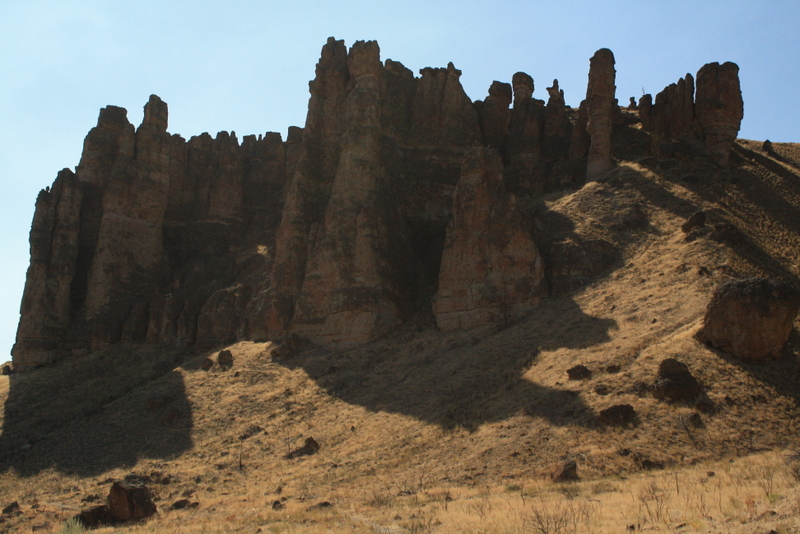 |
| We found out these are around 50 million years old. In fact, we found out that some Americans believe the earth is older than 6,000 years. Old sycamore leaves from when Eastern Oregon was a tropical climate similar to Panama today. |
 |
| Our first Burner siting. We are for sure now on the path to the burn... |
 |
| On the Deschutes River at the old mill site where there are fancy shopping malls and eateries in Bend |
Friday, August 17, 2012
Hiking the trail on Joss
One of the best feeling in life is to walk on snow in the summertime.
Luckily, we've had a bit of that this summer, under especially clear and visibility unlimited skies. Another best feeling in life is to look up at the sky when there is no moon and you don't have to freeze your butt off!
Two nights of a stellar milky way and the aurora glow backlighting the mountains looking north is enough to make me smile. I think if we sent all the world leaders up into the space station maybe then we'd get some effort on protecting this very special planet we live on.
Maybe they just don't realize what we have...
 As the summer days wind down, it seems like when we get up into the upper alpine the bugs are the worse. The blueberry bushes are still flowering like it's mid July and the bears appeared to be low in the valleys with lots of grass in their poop. We saw one bear sign that looked like it had found berries, but most we saw didn't. Of course we talked on the trail and yelled "yo bear" just to make sure we didn't surprise any. It is grizzly country but the wildlife we saw consisted of picas, squirrels, and a very friendly chipmunk whose home was up at the lookout we went to.
 A considerable amount of lookouts were built by the Dominion Government to protect the timber in the Railway Belt. In 1880 the Dominion Government granted to the C.P.R a strip of land extending twenty miles on each side of the main line in return for building the railway. This was known as the Railway Belt and included all of Hunters Range. This Railway Belt, incidentally, was turned over to the Provincial Government in 1930. The Railway Belt, although it was still administered by the federal government, actually belonged to the railway. Joss Mountain Lookout was built in 1921, Eagle Pass in 1922 and Mara Mountain, one of three peaks on Hunters Range, in 1925. All the lookouts had trails and telephone lines into them.* In 1930 the Joss Mtn lookout was decommissioned. It was restored in 2005 by Columbia Helicopters with the BC Fire Service, they put a new roof on it and put up new windows.
The area is also the headwaters of the Shushawp River which is pretty cool since all the water goes into the lake that provides summer swimming enjoyment for thousands of Albertans and Shushawp residents. This is a place kept secret apparently, but just as scenic as Revelstoke without the park fee (and several clearcuts in the valley bottom at various stages of regeneration). Plus you could sleep in the lookout for free!
 Some mountain bikers had found it though and they made it to the top evidenced by their registration in the lookout notebook. I doubt I'd ever mtn bike it as hiking was good enough for me, but Mark would consider it I'm sure. It's not like anyone banning riding mtn bikes on crown lands, and luckily it's a little too rugged to ride in on an ATV to prevent that ATV-kind-of-mtn-meadow damage. But in the wintertime a smart snowmachine rider could easily find their way up there - and it looked like several parties did last winter. Just hope everyone packs their trash out.
*Referenced from http://www.enderbymuseum.ca/thepast/geog/gorich.htm
Luckily, we've had a bit of that this summer, under especially clear and visibility unlimited skies. Another best feeling in life is to look up at the sky when there is no moon and you don't have to freeze your butt off!
Two nights of a stellar milky way and the aurora glow backlighting the mountains looking north is enough to make me smile. I think if we sent all the world leaders up into the space station maybe then we'd get some effort on protecting this very special planet we live on.
Maybe they just don't realize what we have...


The area is also the headwaters of the Shushawp River which is pretty cool since all the water goes into the lake that provides summer swimming enjoyment for thousands of Albertans and Shushawp residents. This is a place kept secret apparently, but just as scenic as Revelstoke without the park fee (and several clearcuts in the valley bottom at various stages of regeneration). Plus you could sleep in the lookout for free!

*Referenced from http://www.enderbymuseum.ca/thepast/geog/gorich.htm
Friday, August 10, 2012
Endangered Gems in Southeastern BC
 We recently returned from the Vahalla Provincial Park which was protected through the actions of local citizens in New Denver in 1975 who started the Vahalla Wilderness Society.
Throughout my visit, I reflected with gratitude for these hard working people to convince the BC Province that this place was special and needed to be conserved for future generations of humans and bears.
Currently, there are many, many conservation battles that are being fought in British Columbia.
I wrote earlier about the proposed park in the southern Okanagan (July 26, Oh Summertime in Canada), and I wanted to share about three more important causes that are being fought for to keep the planet healthy in Southeastern British Columbia.
Canadian recognition of the Sinixt Nation
I want to include the people of the Sinixt Nation in this list, not that they need to be conserved according to the British Columbian and Canadian governments... they have been declared EXTINCT! The land where Mark and I met in Halfway Hotsprings is Sinixt Territory, located on a drainage that feeds into the now damned Arrow Lake. Coming north from the Kootenay River up the Slocan we drove past Frog Mtn and the land where the Sinixt Nation is reclaiming their First Nation Aboriginal Land Claims. I found a really good article on the web by Rex Weyler, "Back from Extinction".
 |
| Galena Bay where the Arrow Lakes Ferry Crossing is, also Sixint traditional lands and water |
Jumbo Glacier Resort at Jumbo Pass
Well, doesn't British Columbia need another ski area that's a sham for selling real estate and building condos? The provincial government is a proponent of it that's for sure. They've even nominated the area as a municipality for a resort community like Golden, Invermere, Osoyoos and Whistler. And nobody lives there! How can it be a municipality? Anyway, perhaps you've seen the bumperstickers "Keep Jumbo Wild" and wonder if it has to do with pink elephants and drinking. Instead, the Jumbo Pass area is a very large roadless area in the northern Purcells that very easily could have had the trans-canada hwy go through there (they decided on Rogers Pass). For the past 20 years, people have wanted to build a ski area there. On the Farnham glacier, people have trained for the Olympics there. And for 20 years, local residents and First Nation people, particularly the Ktunaxa, have protested the development. I just learned during this web search that the Ktunaxa and the Sinixt are in collusion with one another which is terribly unfortunate. This blog, explains that circumstance and the conflict that exists - once again it sounds like an opportunity for a government to take advantage of feuding First Nations to promote economic development at the expense of not only people but the environment. Either way, I'm sure the Grizzly Bears don't care. If they could vote, I suspect they just want the property to remain like it is. My vote is with the bears. And I'm a skier too.
Selkirk Mountain Caribou Park


What's really interesting is that I've learned that British Columbia has stopped using the official branding, "best place to live". Maybe the politicians have officially acknowledged their lack of caring to keep it that way.
Friday, August 3, 2012

Nelson again

We're up on Pulpit rock above Nelson with my nephew Derek, on a warm-up hike for our weekend adventure in the Valhallas!
-mark.
Subscribe to:
Comments (Atom)