
Just sitting on the rocks at the end of the beach watching the sunset. A little while ago someone from the dive shop walked up the beach to warn everyone that a shark had been spotted near shore, so we decided not to go for another swim.
- mark.
Just sitting on the rocks at the end of the beach watching the sunset. A little while ago someone from the dive shop walked up the beach to warn everyone that a shark had been spotted near shore, so we decided not to go for another swim.
- mark.

- mark
 We got up early to see the sunrise over the Pacific (or the coral sea, as this part of it is known). Then we packed up and headed out early to avoid the heat.
 We took a little side trip up to The Boulders, just west of Babinda, to try to see a cassowary (someone told us they'd seen one here). Again, no luck for us. We did see some sugarcane being harvested though.
 We swam in the safe pool at The Boulders, just downstream from here is pretty dangerous water, with warning signs all around. The biggest danger for us was the biting flies! They're a bit like a small horsefly - I think they call them march flies.
 Back on the road, we stopped at Fishery falls for another ginger beer, then past farms and into the city.

 Then we got to Innisfail (there's also an Edmonton just south of Cairns too, but we didn't find a Calgary).
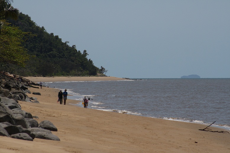 After a tour through Flying Fish Point (a place we were told was good to spot a cassowary, but no luck), we got to Bramston Beach.
 We had to have ginger beer at the cafe, of course...
 We got to try "billy and damper", which turns out to be tea brewed in a pot (billy) over a fire, and bread cooked in something like a dutch oven. Very yummy, especially with the cane sugar syrup!
 They had some old logs in the park which were carbon dated to 1136 or something (when it started growing, the tree fell just a few years ago). Huge old growth - too bad there's not much of it left. It would be impressive to see a stand of trees this size.
 Then we got ourselves out to Millaa Millaa falls, where we had a swim under the falls before the ceremonies began...
 The Ma:mu people were having a "welcome to country" event with several bits about "sharing culture". We got to see some aboriginal dancing accompanied by didgeridoo (I had to look up how to spell that, so if it's wrong, don't blame me, blame google). It's really amazing how little animosity there is between the aboriginal peoples and the European settlers, considering some of the history (including settlers shooting "troublesome blacks")!
 and Elinjaa falls. Then we had to hustle down the road to get to Henrietta Creek before dark. Several people told us it was all downhill from Millaa Millaa, so we were a bit disheartened to see the sign saying 8% grade for 2.5km - it was up, not down! Luckily, there was about 5km of down after that to get to Henrietta creek.
 We got the tent set up just as night fell, and cooked our spaghetti in the dark. Ciel went for a dip at the swimming hole in the creek and came back telling me "it's warm! you have to go in!", but she must have re-calibrated her thermometer, as it was a bit of a shock for me getting in the water!
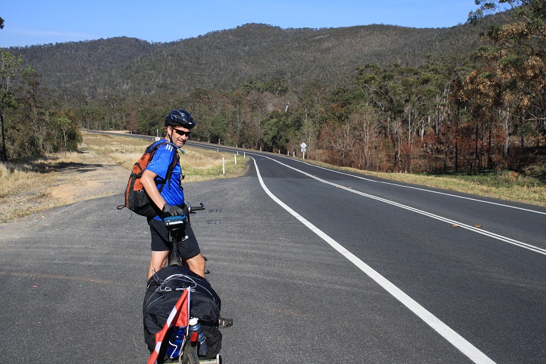
 We got out of the forest without being eaten by carnivorous ants, and headed up the road. there were a few climbs before we got to this unexpected sign: "Highest Declared road in Queensland, Elevation 1143m". Not quite Highwood pass, but we're quite happy with that!


 It took us a long time to leave the caravan park at the hot springs, as lots of people came up to talk to us, curious about our bikes and trailers and where we were going.


 I set the alarm on my watch for 5:20 in order to get up early enough to avoid the heat going over Mt. Misery (we made sure we filled all our water bottles in case it took us longer than planned to get down to the Kennedy highway about 40km south of Irvinebank).


 The climb from Atherton to Herberton was unexpectedly long and steep, but not as bad as the Gilles would have been. Thankfully, there was a lot less traffic too!


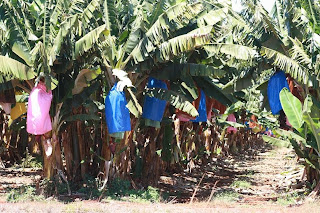
 We headed west out of Mareeba to avoid the main road as much as we could, and also to see Granite Gorge about 12km outside Mareeba. It's too bad re didn't know more about the place beforehand, as it would have been a nicer place to spend the night than the caravan park in Mareeba. We didn't want to spend the $15 they were asking just to go in for the day, so we were back on the road after a bite to eat. This is sugar cane-growing country, so there are lots of cute little railways for the cane trains - the rail spacing is only about 60cm or so. If Matthew W. lived here, he'd have cane railways in his back yard!


 From Lake Tinaroo, we headed back up the road to Kauri creek road which goes over the range and down into Mareeba. The first part of the ride was a bit of a test: 500m of elevation gain in 10km. It's a good thing we left early in the morning, it's pretty sweaty riding uphill in the rainforest!
 . We started seeing the iconic termite mounds in the more open, grassy area we were now riding through.
